


Records tumbled in rows in the last days of October 2022: even in northern Germany, there were still enough peaks that make up a summer day, for example in Helmstadt, where more than 25 degrees Celsius were measured on Friday, October 28, as reported by NDR. Austria also reported the country's latest tropical night so far on Friday: over 20 degrees Celsius at an altitude of more than 1100 meters. At the Hohenpeißenberg in Bavaria, a higher value of 25.4 Celsius has never been measured in the third decade of October since records began in 1879 than on October 29. And so on.
In general, the entire month is on record course: with an average of 12.5 degrees Celsius, it is on par with the previous leader from 2001. The detailed evaluations must show whether he exceeds it. In other countries of southern and Western Europe, too, the temperatures reminded of midsummer rather than the approaching winter.
The October summer has been caused in recent days by a well-established, very stable weather situation: the strong low "Iris" was over the North Atlantic, the high "Zacharias" was over southeastern Europe. Due to their typical rotational movement – the low against, the high with a clockwise direction – they led very warm air from the Mediterranean and North Africa far to the north and central Europe with a strong south-west current.
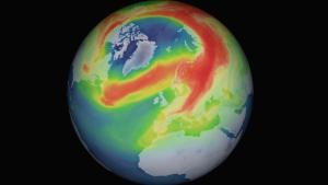
The warm air supply was supported by an intensive jet stream: above the Atlantic, he booked far to the south around the deep to flock north to the east of it. Central and Western Europe were located east of the Jetstreamast and thus on the warm side. With the air masses, however, Sahara dust came north again and again, which at least temporarily clouded the sky and contaminated the warmth.
In the next few days, the weather situation will change: from Allerheiligen, low pressure foothills will reach Central Europe. They initiate a temperature drop to values between 12 and 16 degrees Celsius, which are more typical for the season, but only bring some rain locally – especially the east and southeast initially remain under the influence of the strong Southeast European high and thus rather dry. It is not until the first weekend of November that it is supposed to get wet here as well and snow will fall on the mountains.
It still has to be shown whether the transition to permanently colder weather is done. The signs are more likely to return to the southwest situation - rising temperatures.