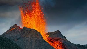


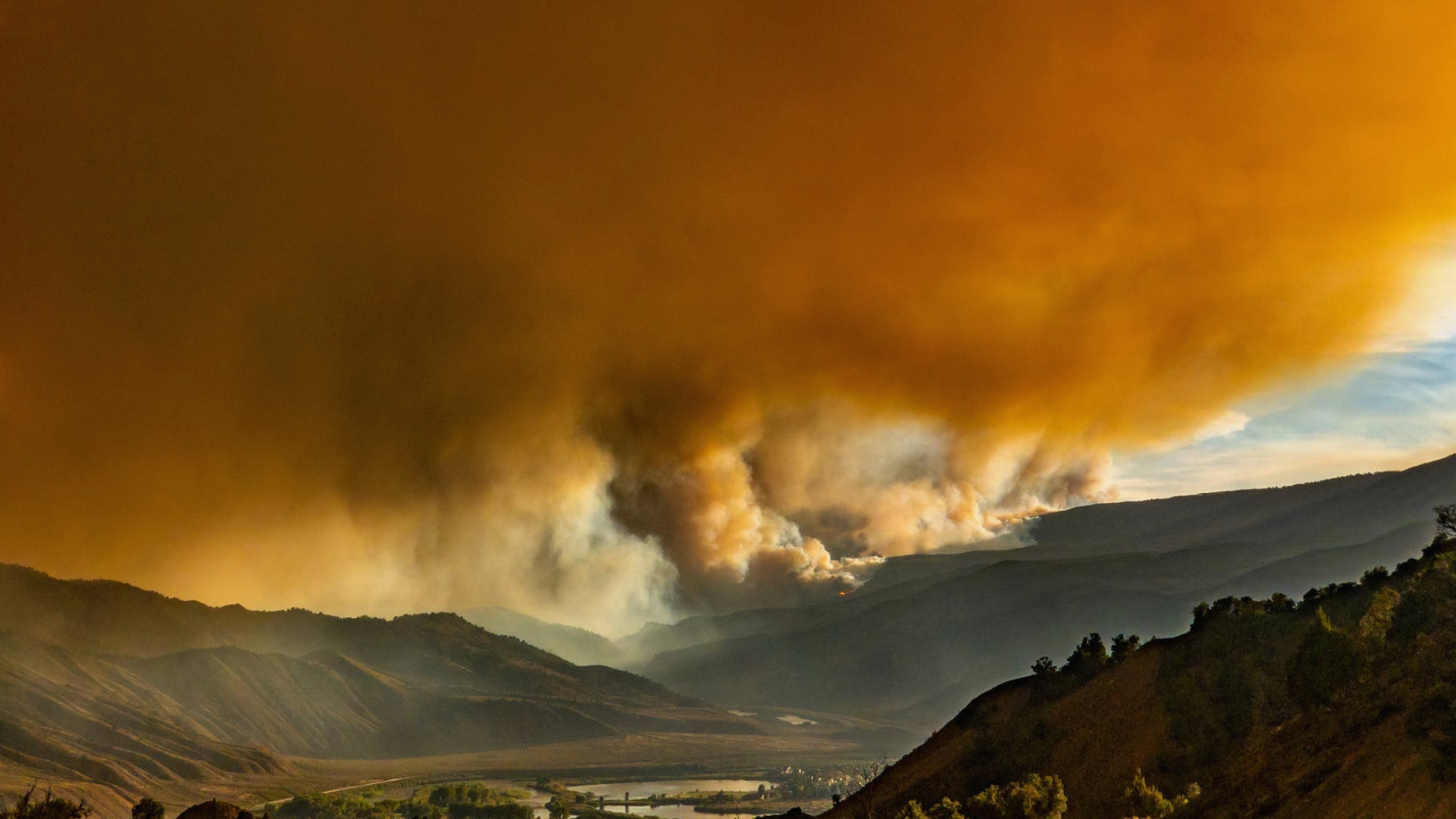
In the summer of 2021, ideal forest fire weather prevailed in the south of the Canadian state of British Columbia. Hot high-pressure air settled over the area like a cheese dome and temperatures had risen to record levels after months of drought. An average of 40 wildfires per day broke out in the province in early July – it was one of the worst wildfire seasons on record.
The fires also destroyed the forests on steep slopes over important infrastructure. The trans-canada highway, the national railway lines and oil and gas pipelines run through the valleys. And after the fire there was another danger to her: landslide.
In mid-November, a huge storm brought an entire month's rainfall to the region in just two days. This so-called atmospheric river released huge masses of mud and debris from the burnt, scarred slopes, which then swept across roads and railway lines.
"The avalanches cut several important transport corridors in the west of Canada," says Matthias Jakob, geoscientist at BGC Engineering in Vancouver, Canada, who was then involved in the assessment of the potential for landslides in the region. "The result was a critical interruption of the supply chains."
More landslides will occur.
Although landslide are not as fatal as vertebral storms or heat waves. Nevertheless, they too could cause economic damage of hundreds of million dollars, says Jakob. After a year of intensive and widespread fires, landslides are expected again this winter, atmospheric rivers should flood the northwest of the United States and British Columbia again.
The one-two punch of fire and flood is just a taste of what awaits people in northwestern Canada and other regions of the world. Worldwide, climate change is increasing the frequency and intensity of fires and leading to extreme precipitation events. Heavy rain, however, when it hits recently burned slopes, can trigger a particularly deadly type of mudslide: the so-called debris flow. An aqueous mass of earth, stones and other material falls down the slope with devastating force.
For regions that are susceptible to such dangers, researchers have already developed models that can feed warning systems and save lives. But today forest fires also devastate mountain slopes that have so far hardly been affected by fire. And not only in the boreal forests of Alaska and Canada, but also in the mountains of Austria, where fires blazer more frequently and more intensively than ever before.
"Even in areas where they were previously only a theoretical possibility, the probability of fires and mudslides will increase," says Bruce Malamud, a geophysicist at King's College London.
The soil becomes water-repellent due to fire.
The central region of British Columbia has always had wildfires. Today, however, they can even be found in the coastal areas of the province. Unfortunately, the forecast models for inland mudslides cannot be applied to these regions. The soils and vegetation here are simply too different for that, says Jakob.
The situation is similar in the United States, where in 2021 parts of North California, Oregon and Washington burned down, which are otherwise hardly affected. "There are indications that the appearance of murgeon lengths in these wet regions with stronger vegetation follows others than in the dry southwestern states, where fires and landslide are more common," says Jason Kean, hydrologist at the National Landlide Hazard Program of the United States Geological Survey (USGS) in Golden, Colorado. What happens in the drier areas is reasonably clear, but the further you look north, the more unclear the picture becomes. "So at the moment we are busy collecting data to find out how well our current model works and how we can improve it," says Kean.
When rain falls on overgrown slopes, the water usually gets stuck on plants. Then it gradually flows or drips to the ground and seeps into the earth. After fires, the rain hits the ground with full force. In addition, the waxy compounds with which leaves and needles are coated evaporate during a fire and partly condense on the cooler soil particles just below the surface.
In this way, a water -repellent layer can form, which prevents the soil from absorbing water. "As a result, the soil no longer behaves like a sponge that sucks up the rain, but like a huge plastic film on which the water runs," says Gary Sheridan, soil scientist at the University of Melbourne, Australia.
Landslides are challenging.
The rain spends on this water -repellent layer until it finds a gap in the ground through which it can seep away. In the event of strong precipitation, however, only a part seeps away, the rest forms channel. These rivulets flow downhill, unite, tear earth and stones with themselves and gain enormous punch. This is how a mural can arise.
"The amount of rain does not have to be large if the precipitation is heavy enough," says Stefan Doerr, forest fire researcher at the University of Swansea in the UK. »Especially shortly after a fire, the necessary material simply lies around and can be carried away.«
The dependence on very intense precipitation makes mudslides difficult to predict. For example, in October 2021, an extreme storm over California and the Pacific Northwest broke records for 24-hour rainfall in several regions. Although this so-called bomb cyclone caused several flash floods, it did not trigger any significant mudslides in burned regions.
"It is not about the total rain, but about the intensity of the rain," says Nina Oakley, research meteorologist from the Scripps Institute of Oceanography in Sanin Burnt Regions Diego, California, which researches the connection between extreme regeneration and landslides. "For this reason, you need precipitation data of at least 15 minutes for the prediction of mura exits according to fires."
Searching for a warning system
Small avalanches and comparable slope slips cause enormous damage. "In the United States alone, the direct economic costs are roughly valued several billion US dollars a year," says Jonathan Godt, coordinator of the program for landslides at the USGS. The indirect costs, which also include losses in retail and related factors, are likely to be a multiple of this estimate.
In January 2021, the U.S. Congress passed the National Landslide Preparedness Act. According to this "Landslide Preparedness Act," U.S. federal agencies are expected to receive $37 million annually between 2021 and 2024 to expand their efforts to reduce the risk of landslides. One of the goals of the law is to expand existing early warning systems for scorched landscapes in the United States.
During a forest fire, research teams travel to the area, usually before the last flame gone out. Among them are soil customers, hydrologists, biologists and experts for landslides to assess the damage. The US Forest Service researchers then evaluate the effects of the fire on the vegetation from the ground and from the air. They also compare satellite images from before and after the fire. They forward the results to landslides of the USG, who feed their models with the data and create danger cards that indicate the potential for degrees of mura in the region.
Among a variety of other variables, these models take into account the size and gradient of the affected area, the intensity of the fire, and the nature of the soil. On the basis of such information, the models calculate how likely mudslides are depending on precipitation intensity. However, these predictions have so far been based solely on the statistical regularities of previous mudslides after fires in the southwestern United States.
Each landslide is unique.
In this part of the U.S., the slopes all have similar vegetation and soil structure, so the models have worked well here, for example after a fire in Glenwood Canyon, Colorado, in August 2020. Researchers quickly studied the damage caused by the fire and fed the data into a model that helped emergency managers estimate the risk of mudslides as rainfall approached.
In mid -2021, the warning system prompted the authorities to block the interstate 70 - a highway that leads through the canyon. In fact, during the closures there were several misery on the main traffic road, which caused damage to the highway in the amount of several hundred million US dollars. There were no fatalities.

For other regions, on the other hand, the USGS models are of limited significance because the environmental conditions differ too much from those in the dry southwest. This became clear after a fire spread on the slopes of the Columbia River Gorge in Oregon in September 2017. On the steep, wooded slopes, fir trees usually tower over a dense, lush undergrowth of ferns and bushes.
The fire burned the vegetation in an area of 20,000 hectares. But despite some violent storms, the catastrophe failed to materialize in the following three years. It was not until January 2021 that heavy rainfall triggered a fatal mudslide. A car that drove through the gorge was carried away. The driver died.
Delayed catastrophes
This late disaster was no surprise for the geologist Joshua Roering from the University of Oregon in Eugene. He has been researching landslides in the northwest of Pacific for almost two decades. Among other things, Roering's group examined to what extent the soils behave differently than those in drier areas after a fire. As your work show, the water -repellent layer on the floor after a forest fire in the northwest of the Pacific is not as consistently as further south.
For example, during extreme rainfall after a fire, the water can penetrate into the ground. "The fact that several severe storms in the region did not trigger debris flows suggests that the hydrological system behaves differently here than in Southern California," says Roering. However, this does not mean that there is no danger after a forest fire in the northwest.
Rather, the risk of mura exits is delayed, which researchers otherwise observe after the wood harvest. If a tree is felled, its roots decompose over several years. The more the trees lose their hold, the higher the risk that the slope will slip when it rains. "It doesn't matter how to kill a tree," says Roering. "In three, four or five years, the root systems in the upper meters of the soil will lose about 90 percent of their strength."
If this description of the landslide risk in the forested Pacific Northwest is confirmed, researchers and emergency managers would also have to include in their forecasts those storms that occur several years after a forest fire. "Then we are sitting on a ticking time bomb, so to speak, in terms of heavily burned areas with steep slopes over important traffic corridors and highways," says Roering.
Houses cannot flee.
For the drier central region of British Columbia, which has a different soil structure than the coastal regions of the Pacific Northwest, researchers do not expect the same delay. "We have to develop our own model for British Columbia," says Jakob. "But we need a lot more data for that."
In Australia, too, researchers deal with the changing patterns of fires and floors. In the southeast of the continent, where Gary Sheridan works, forest fires are the order of the day. In the meantime, however, they also appear in the damp, alpine areas of Tasmania. Instead of developing a completely new landslide model, Sheridan's group tries to refine their models with the data of these fires and then assess the predictive power at the murgeon lengths. According to Sheridan, a difficult and lengthy process.
"Wildfires can have a wide variety of consequences, from almost no change in the landscape to catastrophic mudslides," says Sheridan. The international landslide research community is currently discussing a number of common factors that could be incorporated into a universal prediction model. However, such a model is still a long way off. The landscape, climate and behaviour of the soil simply differ from place to place: "The risk is different in every place. We still don't know why."
Models of such landslide help to save lives. It becomes more difficult if you also want to protect buildings or transport networks. "British Columbia simply does not have the necessary money to protect streets, rail lines or pipelines from every single slope that could trigger a mening," says Jakob. "Early warning systems can prevent people from being harmed, and infrastructures are still damaged or destroyed."
Data still isn't there.
With improved models you could identify endangered streets or pipelines in the future. Authorities could use their protective measures more specifically, Jakob suspects. House owners could also use landslide models to narrow down the risks of their property and life. "In view of the dramatic and rapid climate change, many people may not even know that they are endangered by landslides after fires," says Jakob. However, such efforts are not undisputed. Politicians and building contractors are known for defending themselves against the creation of landslide threats because they see them as an obstacle to growth and income.
Landslide researchers therefore need time and more storms to optimize their landslide forecasts after fires. For this winter storm season, many have already installed instruments on the slopes that burned in California's 2021 fires, including the Caldor and Dixie Fire region — the largest single fires in the state's history. Kean hopes that the measurement network will shed light on which precipitation intensities trigger debris flows and which do not, how much water seeps into the soil, how much drains off and much else that will contribute to the improvement of current models or the development of region-specific models.
"The biggest challenge is the lack of resources in relation to the extent of the devastation through the forest fires," says Kean. The Dixie fire alone burned almost 400,000 hectares. But you only have a limited number of instruments. This cupboards the ability to find out something about the behavior of murgeon lengths in new regions.
© Springer Nature The devastating mudslides that follow forest fires, DOI: 10.1038/d41586-022-00028-3, 2022